
Paying the fiddler
This was one of those many trips that you do because you have a couple days, fully knowing that even another half day would be much more comfortable. 
But a little suffering is much better than not going.


In this case, waiting wasn’t an option, unless I wanted to wait until next year, as river flows required for my day 2 closing of the loop were already down to about 65% of the agreed upon bare minimum at the time I started hiking.
No sure water for the entire 25+ miles of hiking makes more days a bit tricky as well.

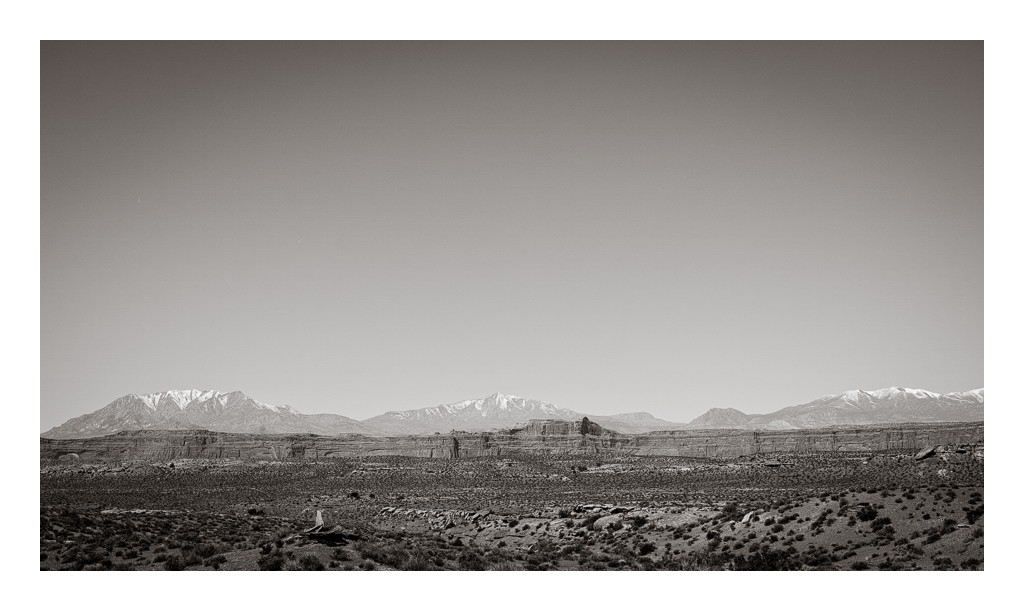
Rock Canyon and Navajo Mtn…


The consequences of being grazed hard by sheep are visible on much of the Block, but looking 10′ to your left and 10′ to your right and seeing 1500′ below on both sides is a view experience that’s tough to beat. And there was water, of course. So it goes.


I cursed myself for trying to take a direct line after dropping off. Steep, loose chinle hills with crazy convoluted drainages was hard.

Seeing the other side, though, I was glad I had. The drainage crossing would have otherwise been much worse.

The maze of drainages below in the moenkopi was impressive and intimidating knowing how tedious it might prove to be. Luckily I picked a great ridge and great drainage.

Monster cairn marking the Chinese Trail…


From whence I came…


Rim walking in the late afternoon was pretty glorious despite a nagging headache.


Lots of great plants. Amsonia sp near the mouth to the Devil.

I was pretty beat reaching the river, and while in the Grand a few weeks ago boating meant rest, I knew better here. First sight of the water in the evening didn’t inspire confidence. I hiked another part of a bend to pass a shallow rocky section I’d be dragging anyway.


Things got better, though, and despite a lot of towing, it was still awesome.


A pretty serious headwind was getting more serious around the time I stopped for some lunch so it was bench walking the rest of the way.

Equally enjoyable as far as I’m concerned…


Some surprisingly fun slickrock hiking only a couple hundred meters below the highway back to my bike, ~7 mile ride to the truck, and home.


excellent photography, and the route looks spectacular – thanks for the writeup
Great stuff. Looks like an incredible loop albeit some boney flows.. I’m thinking this could be a good loop come monsoon season – hike in and catch the flow as the river rises. Maybe that is a bit optimistic. Seeing this lower stretch when I was down there gave me warm fuzzies about the river patiently reasserting herself. Thanks for sharing.